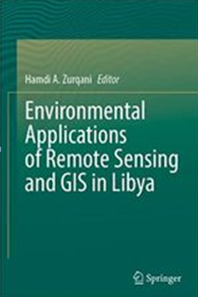
أصدرت دار النشر العالمية Springer أول كتاب باللغة الإنجليزية عن التطبيقات البيئية للاستشعار عن بعد ونظم المعلومات الجغرافية في ليبيا بعنوان:
“Environmental Applications of Remote Sensing and GIS in Libya”
وقد أشرف علي تحريره الدكتور حمدي عبد الخالق الزرقاني الأستاذ المساعد بجامعة أركانسا، الولايات المتحدة الأمريكية.
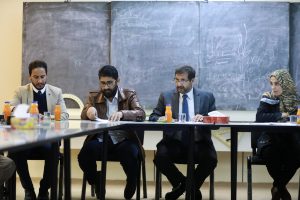
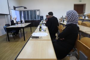
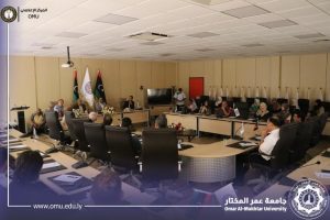
وقد ساهم في انجاز هذا العمل المتميز نخبة من العلماء والباحثين من العديد من المؤسسات العلمية المتميزة من بينهم أساتذة وباحثين من جامعة عمر المختار وهم:
- الدكتور عبدالسلام البخاري (الفصل الثاني، الثالث، والعاشر).
- الدكتور مراد بوراس وفريقه البحثي (الفصل السادس).
- الدكتور صلاح بوعوينة (الفصل الثامن).
- الدكتور على بطاو(الفصل العاشر).
- المهندس الساكت الدايخ (الفصل العاشر).
وبهذه المناسبة تتقدم جامعة عمر المختار بالشكر والتقدير الي السيد المحرر والسادة المشاركين في هذا العمل لإسهاماتهم المتميزة والرفع من سمعة جامعة عمر المختار والارتقاء بها.
———————————————————————————————————————
© 2022 “Environmental Applications of Remote Sensing and GIS in Libya”;
Editor: Hamdi A. Zurqani (Ed.)
• Presents a unique source of remote sensing extracted information and GIS applications in Libya
• Enriches understanding and assessment of Libya’s environment from different points of view
• Provides detailed methodological research approaches of using remotely sensed data in soil properties modeling
• Includes case studies that illustrate remote sensing and GIS roles in solving Libya’s environmental problems
#Ch_1. Zurqani, H. A. (2022) Introduction to “Environmental Applications of Remote Sensing and GIS in Libya”.
#Ch_2. Zurqani, H. A., A. Al-Bukhari., and Shanta M. B. (2022) Application of remote sensing and GIS in land cover/land use mapping and change detection using Google Earth Engine platform: a case study in northwestern Libya.
#Ch_3. Al-Bukhari., A., T., Brewer, and S., Hallett. (2022) Evaluation of selected vegetation indices to assess rangeland vegetation in eastern Libya
#Ch_4. Elfadli, K. I., and Zurqani, H. A. (2022) Spatiotemporal analysis of Vegetation Health Index (VHI) and drought patterns in Libya based on remote sensing time series.
#Ch_5. Zurqani, H. A. (2022) Integration of remotely sensed data and machine learning technique for spatial prediction of selected soil properties in northwestern Libya.
#Ch_6. Aburas, M. M., A. S. Alferjani, and M. S. Yousuf. (2022) Field and laboratory estimation of soil erodibility, erosion, and degradation of the semi-arid AljabalAlkhdar region, Libya.
#Ch_7. Ellafi, M., H. A. Zurqani., L. K. Deeks., and R. W. Simmons. (2022) DRAINMOD applications to design drainage systems in Libya using soil salinity data predicted by GIS, remote sensing, and Artificial Neural Networks.
#Ch_8. Hamad, S., and N. Patel. (2022) Surface water potential and suitable sites identification for RWH in the semi-arid and arid watershed of WadiSammalus, northeast Libya using GIS and Remote Sensing.
#Ch_9. Salim, A. M., Albira., I. A., and S. A., Ebsheer. (2022) Stepwise approach for morphometric modeling of Wadi Zamzam watershed in north-western Libya using GIS and remote sensing techniques.
#Ch_10. Zurqani, H. A., A. Al-Bukhari., A. O. Aldaikh., K. I. Elfadli., and A. Bataw. (2022) Geospatial mapping and analysis of the 2019 Flood Disaster extent and impact in the city of Ghat in southwestern Libya using Google Earth Engine and deep learning technique.
#Ch_11. Abdunaser, K. (2022) Oil pollution monitoring and detection using GIS and remote sensing techniques: a case study from Libya.
#Ch_12. Zurqani, H. A. (2022) Conclusions and Recommendations for “Environmental Applications of Remote Sensing and GIS in Libya”.